Helping families navigate a historic school campus.
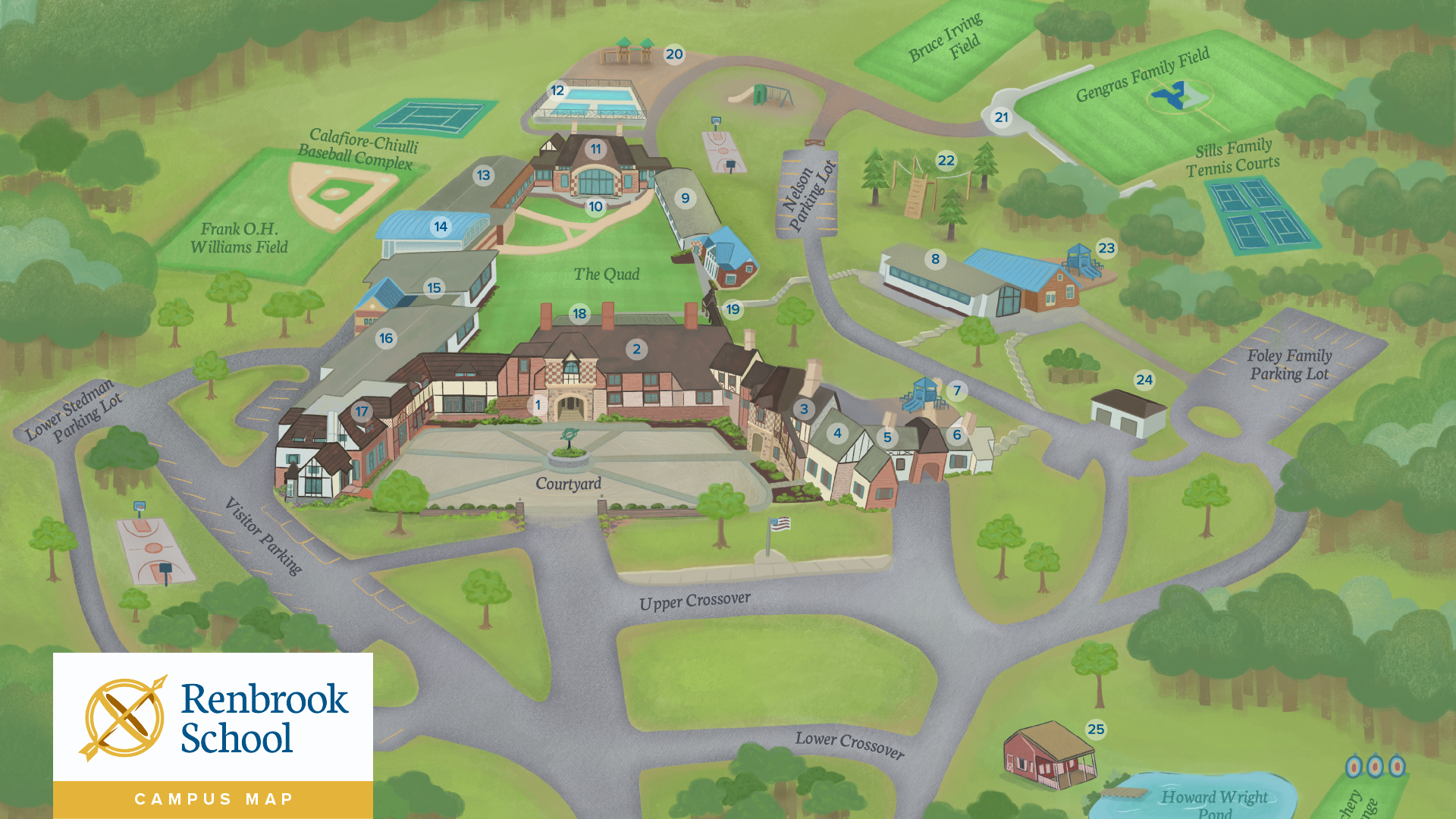
Renbrook School lives on 75 acres of beautiful Connecticut land and has deep historic roots to Avon Mountain. After undergoing a school-wide rebrand, we looked to reimagine the campus map to better highlight the gorgeous campus and improve wayfinding.
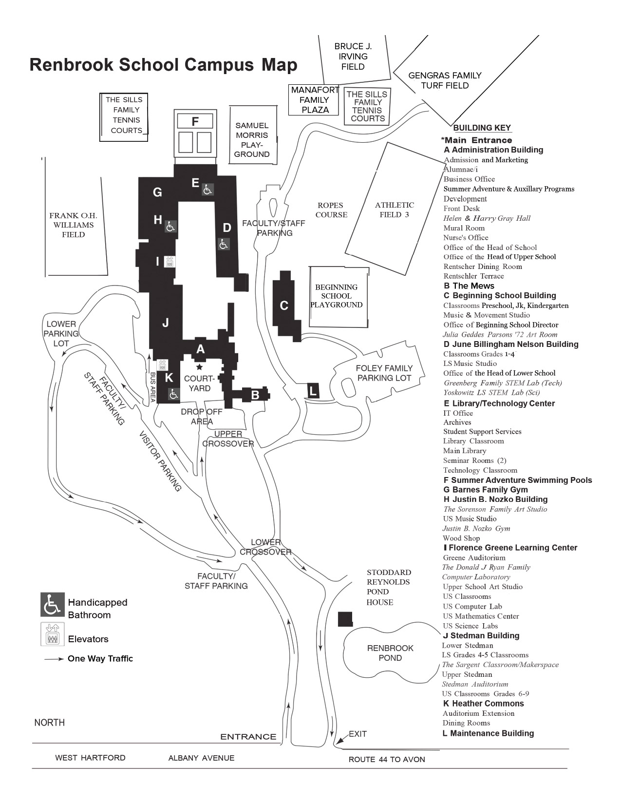
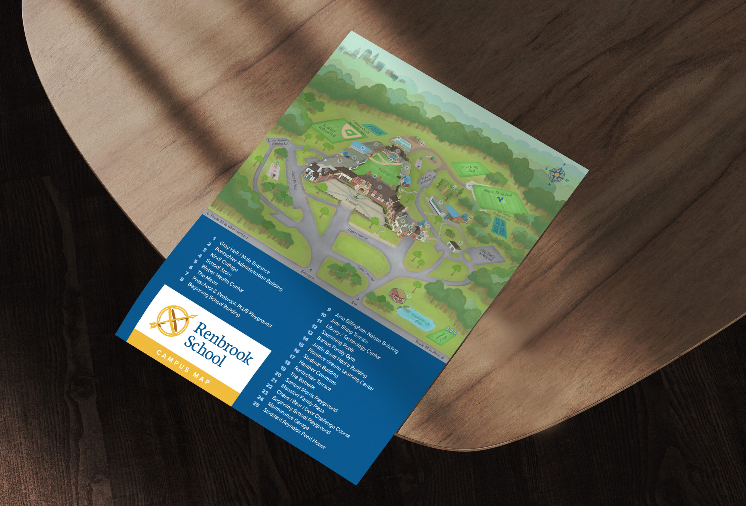
Their old map didn’t give any sense of place, and was so packed with information that it made it hard to use. An illustrative map was a clear solution, as it allowed us to give people a visual of the campus and better highlight the needed information.
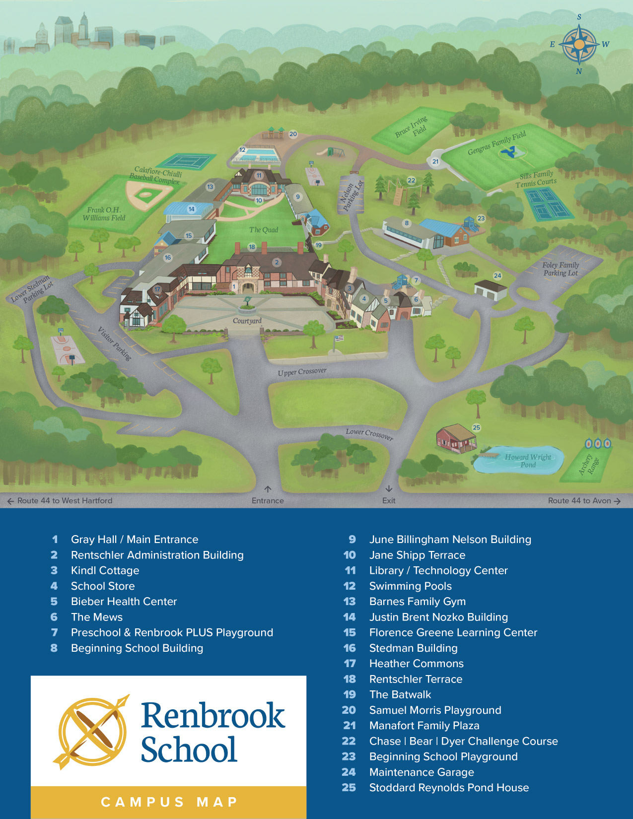
The process started by creating a sketch of the map to figure out how to best render the buildings and layout the entire piece to better accommodate the map key. This map will be printed out and used in welcome folders, so it had to fit the standard letter sized paper.
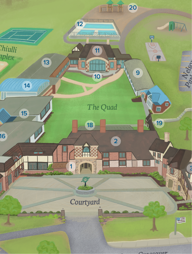
Because the buildings would be rendered in perspective, it allowed the illustrated portion of the map to take up less vertical space on the paper. This meant that there would be more room for the key to occupy the bottom section, keeping it clear and easy to use.
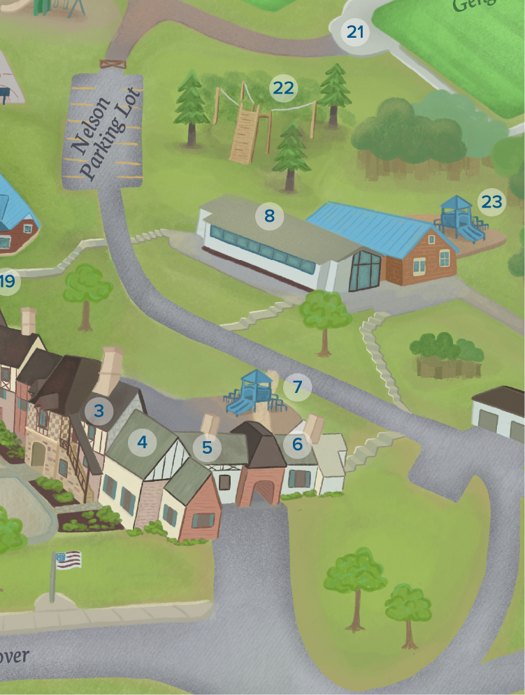
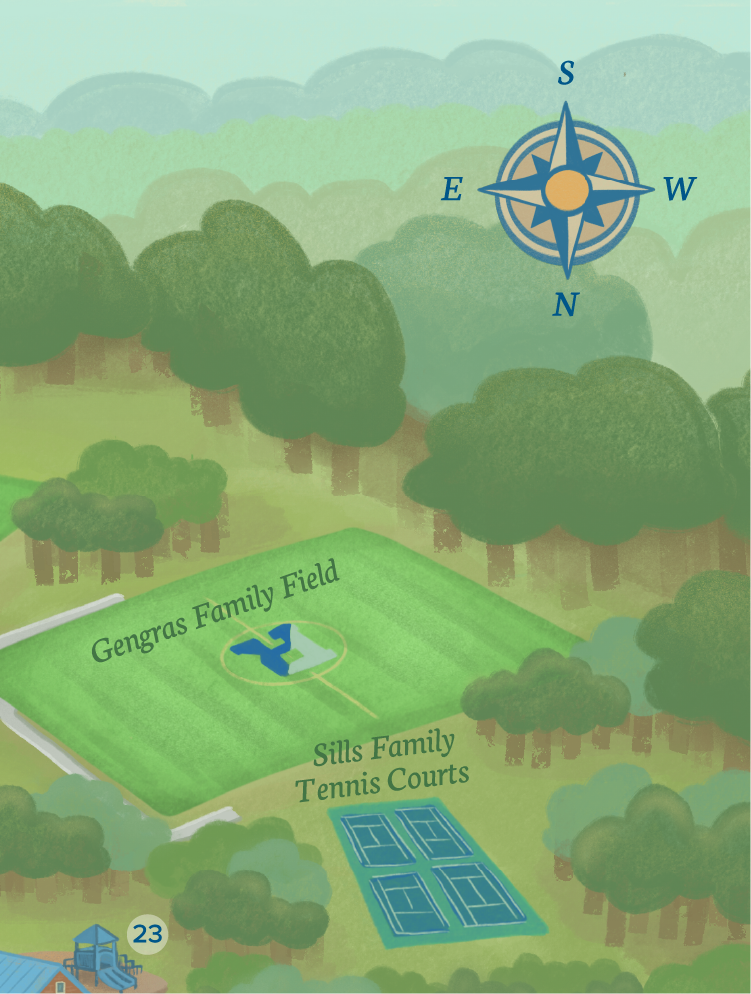
Once the sketch was approved, all the details, color, and styling were added. The result is an illustration that gives an immersive view of the campus. This hand-drawn map showcases the unique Tudor architecture, lush forestry, and valuable on-campus offerings the school provides for students.
“Madison has that rare combination of artistic talent, strategic thinking, technical expertise, and an incredibly easygoing, collaborative approach. She listens carefully, asks the right questions, understands what we’re trying to accomplish, and brings ideas to life in ways that consistently exceed expectations. Her process is thoughtful, organized, efficient, and genuinely enjoyable from beginning to end.
Our new campus map is a perfect example of her talent. It is a beautiful piece of illustration, but what makes it truly remarkable is how functional and accurate it is. Madison captured the distinctive architecture of our buildings, the character of our landscape, and the many details that make our campus special. The result is not simply a map that helps people find their way; it is a visual celebration of Renbrook, one that feels authentic to our school and reflects our brand beautifully.”